
 Posts
Posts




Second visit last night.
The female was perched on the same ledge that I suspected was the pair's potential nest site. She sat low on the ledge, suggesting that she was incubating eggs. I sat atop the Mogollon Rim for two and a half hours and never saw the female leave the ledge. I never saw the male either.
I suspect that on my next visit in June, I'll see some nestlings... stay tuned.
Saturday, May 16, 2009


Sunday, May 10, 2009
Mt. Wrightson via Madera Canyon

Another early morning. You've got to get out there early if you want to beat the heat.
I pulled into the parking lot and got on the trail just as the sun began to illuminate the canyon. I hit the trail and started the climb. And I mean climb. With the exception of Josephine and Baldy saddles, it was a consistent ascent... from 5,420 to 9,453 feet above the sea. The forest was alive with birdsong. Madera Canyon is a hotspot of bird diversity and a popular Sky Island stop for birders from all over the world.
I followed the Old Baldy Trial through a forest of oak trees as I climbed towards Josephine saddle. Along the way I spotted Swainson's thrushes, spotted towhees, and a myriad of difficult to identify warblers flitting through the trees. I had the privilege of being the first person on the trail and that provided me with a great opportunity. As I made my way up the trail, I came upon a black bear skulking through the forest. It was a great treat for me. To make it even better, as I sat on a downed log at Josephine saddle, a wild turkey came right up to me! I just sat still as the old gobbler strutted around me and off into the forest.
The rest of the climb was draining. I slogged it up the mountain side, back and forth along the switchbacks. Luckily I was shielded from the early morning sunshine for most of the climb. A gentle breeze kept me cool all the way until Baldy saddle. On the final ascent I was completely exposed to the sun and it was getting really hot. But it was well worth the discomfort when I hit the peak. Unobstructed views in every direction. I could see all the way north to Picacho Peak and south into Mexico.
It was a great hike and I'll definitely be back.
Tuesday, May 5, 2009
Great Day in the White Tanks
An early morning and on the trail by 4am. Only 3 miles "as the crow flies", but with the switch backs and elevation gain the hike was closer to 6 miles one-way. Cloud cover helped buffer the sun's intensity and a slight breeze cooled the skin. Just after sunrise, I spotted three mule deer does drinking from a tinaja downslope from the trail. I sat and watched as they made their way upslope - foraging along the way. Then they disappeared over the ridge above. During the course of the hike I also saw:
2 blue-phase speckled rattlesnakes (Crotalus mitchellii)
2 western diamond backs (Crotalus atrox)
1 chuckwalla (Sauromalus ater)
loads of whiptails (Aspidoscelis sp.), side-blotched (Uta stansburiana), and zebra-tailed lizards (Callisaurus draconoides)
Back to the truck by eleven am. A great way to start the day!
2 blue-phase speckled rattlesnakes (Crotalus mitchellii)
2 western diamond backs (Crotalus atrox)
1 chuckwalla (Sauromalus ater)
loads of whiptails (Aspidoscelis sp.), side-blotched (Uta stansburiana), and zebra-tailed lizards (Callisaurus draconoides)
Back to the truck by eleven am. A great way to start the day!
Thursday, April 16, 2009
Peregrine Falcon Survey Time!
Every three years I look forward to the opportunity to assist with the Peregrine Falcon monitoring here in Arizona. This has to be one of my favorite assignments. Imagine hiking out to some remote cliff face where records exist for a historically occupied Peregrine nest site. You hike in, carrying a pack filled with supplies in case you have to spend the night, and a spotting scope for peeking in on the nest - should you find it. You approach the cliff face, all the while listening and watching for any sign that the falcons are present.
Generally, you're looking for the falcons in flight or perched on a narrow ledge somewhere on the cliff face. The Peregrine falcon has a distinctive dark "helmet" that covers its head and extends to nape of its neck and down side of face where it tapers into dark stripes that almost look like a mustache. These raptors have dark blue-gray plumage on their back, and light breast with variably dark barring. Known for their speed and agility in flight, Peregrines have a distinctive flight profile that will differentiate it from other raptors. The wings are pointed and the tail is short. Wing beats are smooth and powerful.
So anyways, there I was, quickly approaching the nest site with the anticipation of verifying occupancy or, even better, a nest! I reached the edge of the Mogollon Rim and took my position on the ledge where I set up my scope and pulled my field notebook from my pack. Before I could even get my eye to the scope, I heard the whining wail - the “kaak kaak” - of the female Peregrine. I looked through the scope, scanning the cliff face. Then suddenly I saw a falcon fly from a ledge, dropping down into the deep canyon below. The female, still somewhere across the canyon, continued calling. I quickly located her in a tall ponderosa pine snag from her vocal clues. I focused in on the female just in time to see the male fly in and perch right on top of her for a few seconds. Copulation! This was getting interesting.
The male flew off of the perch and disappeared into the canyon a second time. I continued to watch the female falcon, hopeful that she would soon fly to the cliff face where I would then see her nest site. But she stayed perched on the snag with the afternoon sun illuminating her light-colored breast, causing them to stand out against the dark red bluff behind her.
About forty minutes later, she started calling again. Almost immediately, the male reappeared and perched about twenty feet above her in the same snag. Then, he dropped out of the snag and landed on a narrow ledge. He perched momentarily and then the female joined him as if inspecting the nest site that he hoped to convince her to use.
As the sun dropped behind the distant horizon, I smiled to myself, knowing that I'd seen something beautiful and wild. In a couple of weeks I'll return to determine if the pair has successfully nested. I'll let you know how it goes!
Generally, you're looking for the falcons in flight or perched on a narrow ledge somewhere on the cliff face. The Peregrine falcon has a distinctive dark "helmet" that covers its head and extends to nape of its neck and down side of face where it tapers into dark stripes that almost look like a mustache. These raptors have dark blue-gray plumage on their back, and light breast with variably dark barring. Known for their speed and agility in flight, Peregrines have a distinctive flight profile that will differentiate it from other raptors. The wings are pointed and the tail is short. Wing beats are smooth and powerful.
So anyways, there I was, quickly approaching the nest site with the anticipation of verifying occupancy or, even better, a nest! I reached the edge of the Mogollon Rim and took my position on the ledge where I set up my scope and pulled my field notebook from my pack. Before I could even get my eye to the scope, I heard the whining wail - the “kaak kaak” - of the female Peregrine. I looked through the scope, scanning the cliff face. Then suddenly I saw a falcon fly from a ledge, dropping down into the deep canyon below. The female, still somewhere across the canyon, continued calling. I quickly located her in a tall ponderosa pine snag from her vocal clues. I focused in on the female just in time to see the male fly in and perch right on top of her for a few seconds. Copulation! This was getting interesting.
The male flew off of the perch and disappeared into the canyon a second time. I continued to watch the female falcon, hopeful that she would soon fly to the cliff face where I would then see her nest site. But she stayed perched on the snag with the afternoon sun illuminating her light-colored breast, causing them to stand out against the dark red bluff behind her.
About forty minutes later, she started calling again. Almost immediately, the male reappeared and perched about twenty feet above her in the same snag. Then, he dropped out of the snag and landed on a narrow ledge. He perched momentarily and then the female joined him as if inspecting the nest site that he hoped to convince her to use.
As the sun dropped behind the distant horizon, I smiled to myself, knowing that I'd seen something beautiful and wild. In a couple of weeks I'll return to determine if the pair has successfully nested. I'll let you know how it goes!
Monday, April 6, 2009
April Update: For Lack of a Better Title
Kegged it and enjoyed.
Trying to get more brew time but work has picked up. That's good though. I feel very fortunate to have a job that keeps me busy during these tough times. Summer is right around the corner and spring has been busy since February. Lots of field time, lots of data.
Scored some brewing equipment from a friend and will be stepping it up with a 10 gallon batches and a small kegerator.
Trying to get more brew time but work has picked up. That's good though. I feel very fortunate to have a job that keeps me busy during these tough times. Summer is right around the corner and spring has been busy since February. Lots of field time, lots of data.
Scored some brewing equipment from a friend and will be stepping it up with a 10 gallon batches and a small kegerator.
Wednesday, March 11, 2009
Kegging the Scottish and Stout
It's been 6 and 5 weeks since we racked the Scottish Ale and Oatmeal stout, respectively. A buddy of mine told me that I didn't need to wait so long... 3 weeks in secondary is what he recommends. But I'll tell you what, I've used 6 weeks as a standard. As Ste ve says, "It gives the flavors a chance to blend and mellow."
The Scottish Ale turned out light, as we planned. Even without carbonation it has a crisp smooth start and almost no aftertaste. I have to admit that it's a bit lighter than I had hoped. But next to the stout, anything would seem a bit transparent.
The Abby Road Oatmeal Stout is a winner. This beer is the best we've brewed. A rich brew with toffee and butterscotch undertones, this beer is dark and full bodied and has a high gravity. A day with in the fridge with the CO2 and wha-la!
 ve says, "It gives the flavors a chance to blend and mellow."
The Scottish Ale turned out light, as we planned. Even without carbonation it has a crisp smooth start and almost no aftertaste. I have to admit that it's a bit lighter than I had hoped. But next to the stout, anything would seem a bit transparent.
The Abby Road Oatmeal Stout is a winner. This beer is the best we've brewed. A rich brew with toffee and butterscotch undertones, this beer is dark and full bodied and has a high gravity. A day with in the fridge with the CO2 and wha-la!
Saturday, January 31, 2009
Abby Road Oatmeal Stout Update
Steve and I racked the stout to secondary today. We measured the gravity at 1.025. Given our original gravity measurement of 1.06, it looks like we're on our way to an oatmeal stout with about 4.8% alcohol by volume. Not bad for the first time around. Here are our first impressions on this new recipe:
Aroma: Mellow, malty aroma.
Taste: Very low bitterness with a sweet (toffee-ish), malty finish.
Appearance: Overall clarity is excellent. Looks like the addition of whirlflock during the last 10 minutes of the boil paid off. Rich, dark coloration almost like blackstrap molasses.
Finish: Sweet, malty aftertaste.
Overall, we're pleased with the progress of the stout. I can't wait to get it in the fridge.
Prost!
Aroma: Mellow, malty aroma.
Taste: Very low bitterness with a sweet (toffee-ish), malty finish.
Appearance: Overall clarity is excellent. Looks like the addition of whirlflock during the last 10 minutes of the boil paid off. Rich, dark coloration almost like blackstrap molasses.
Finish: Sweet, malty aftertaste.
Overall, we're pleased with the progress of the stout. I can't wait to get it in the fridge.
Prost!
Saturday, January 24, 2009
Superstitions
I'm not talking black cats or walking under ladders here folks. I'm talking the Superstition Mountains! Right now I'm sitting at the base of the Mountains where I'm lucky enough to have a good pal with a sweet pad. I woke up early and sat in the back yard to gaze upon the mountains. So now I'm planning a quick hike up to Weaver's Needle. I'll head out early tomorrow.
Friday, January 23, 2009
Social Media
I am really excited about the opportunity to share photos, stories, and memories with my friends... both new and old! The potential of social media to open up new lines of communication within our social networks is really fascinating. I'm working on a number of projects to re-connect myself to the growing circle of people looking to get in touch and be in touch. Keep your eyes pealed for some of my upcoming projects, the most exciting of which will be brewmeister.tv... My brew partner Steve and I will be bringing you closer to one of our favorite hobbies... homebrewing. It's easy! We'll show you just how easy it is. Hey, if we can do it... so can you!
Thursday, January 1, 2009
Monday, December 29, 2008
End of 2008 Already!
Wow. Where did the year go?
I can't believe that we're almost ringin' in 2009.
I've been spending the day with family in Duluth, talking over the past year... trying to remember what we all did to fill the time. It was a seriously wild ride.
I spent the majority of the summer working - probably more than I ever have in the past. The only thing was... I loved (almost) every minute of it! Most of that work revolved around the tortoise projects that I'm working on. In general, these projects involve assessing and mitigating the impacts that roads have on desert tortoises. Briefly, this work entails hundreds of hours walking across the desert looking for tortoises. Then, once found, we track a sub-set of these tortoises using radio-telemetry and GPS. We assess habitat use, attempts (successful or not) at crossing roadways, and the efficacy of mitigation strategies to reduce animal-vehicle collisions.
It's rewarding work for sure!
Other than that, I did a fair amount of hiking in southeast Arizona... took a trip to see my sister and husband in Ohio... and now I'm home (in Duluth) for the holidays.
But looking back, I cannot believe that we're closing in on 2009. I hope you've had a great 2008. And good luck in the new year!
I can't believe that we're almost ringin' in 2009.
I've been spending the day with family in Duluth, talking over the past year... trying to remember what we all did to fill the time. It was a seriously wild ride.
I spent the majority of the summer working - probably more than I ever have in the past. The only thing was... I loved (almost) every minute of it! Most of that work revolved around the tortoise projects that I'm working on. In general, these projects involve assessing and mitigating the impacts that roads have on desert tortoises. Briefly, this work entails hundreds of hours walking across the desert looking for tortoises. Then, once found, we track a sub-set of these tortoises using radio-telemetry and GPS. We assess habitat use, attempts (successful or not) at crossing roadways, and the efficacy of mitigation strategies to reduce animal-vehicle collisions.
It's rewarding work for sure!
Other than that, I did a fair amount of hiking in southeast Arizona... took a trip to see my sister and husband in Ohio... and now I'm home (in Duluth) for the holidays.
But looking back, I cannot believe that we're closing in on 2009. I hope you've had a great 2008. And good luck in the new year!
Friday, February 22, 2008
2008 Already!
I can't believe we're already well into 2008. Life just seems to move along so darned fast these days. Days become weeks, weeks become years. With my focus always on the future, it's tough to look back - let alone appreciate the present!
Right now I'm in Las Vegas attending the 33rd Annual Desert Tortoise Council Symposium. It's a yearly event where the desert tortoise research and conservation community gets together to discuss current research, policy as it relates to tortoise conservation, and see old friends. The conference began this morning and it's already been an eye opener - from new developments in tortoise behavioral genetics to population assessments of the Sonoran desert tortoise in Arizona, it's been enlightening. But the best part is networking with new friends and touching base with old friends.
My presentation is on Sunday afternoon and I have yet to finish the powerpoint. It's entitled Desert tortoise micro-habitat selection on the Florence Military Reservatoin, Pinal County, AZ. Fascinating right? Well, I better get to work.
Happy New Year and I hope to fill you in on how the presentation went.
Peace!
Right now I'm in Las Vegas attending the 33rd Annual Desert Tortoise Council Symposium. It's a yearly event where the desert tortoise research and conservation community gets together to discuss current research, policy as it relates to tortoise conservation, and see old friends. The conference began this morning and it's already been an eye opener - from new developments in tortoise behavioral genetics to population assessments of the Sonoran desert tortoise in Arizona, it's been enlightening. But the best part is networking with new friends and touching base with old friends.
My presentation is on Sunday afternoon and I have yet to finish the powerpoint. It's entitled Desert tortoise micro-habitat selection on the Florence Military Reservatoin, Pinal County, AZ. Fascinating right? Well, I better get to work.
Happy New Year and I hope to fill you in on how the presentation went.
Peace!
Monday, December 10, 2007
Colorado Get Away!
When I saw the weather forecast for Colorado last weekend, I couldn't help but book a ticket. I'd just watched Warren Miller's new film at the Fox Theater in downtown Tucson and I'd already been jonzing for roughly three weeks. With no rideable snow in Arizona, I just had to do it.
Luckily, Lee and Pan were up for some shreddin', so I headed out Friday afternoon. We rode Keystone on Saturday and Arapahoe Basin on Sunday. There were about three feet of fresh powder and the ridin' was phenomenal. You gotta love those last minute adventures!
Thanks Lee for meeting me in Boulder and for being up to dropping everything else that weekend. And Pan, thanks for putting us up brother!
Pan rippin' down one of Keystone's finest:

Keystone Village:

Me at Keystone:

Lee on the lift:

Loungin' at Pan's place after a long day on the slopes:

Luckily, Lee and Pan were up for some shreddin', so I headed out Friday afternoon. We rode Keystone on Saturday and Arapahoe Basin on Sunday. There were about three feet of fresh powder and the ridin' was phenomenal. You gotta love those last minute adventures!
Thanks Lee for meeting me in Boulder and for being up to dropping everything else that weekend. And Pan, thanks for putting us up brother!
Pan rippin' down one of Keystone's finest:

Keystone Village:

Me at Keystone:

Lee on the lift:

Loungin' at Pan's place after a long day on the slopes:

Thursday, September 13, 2007
Pine River Loop
Paul picks me up at my parent’s house in Duluth. I throw my gear into the truck of his car and hop in the passenger seat. As I close the door, it starts to rain. We stop at Paul’s place and grab the food. Nick and Jonah meet us there. We scramble to get the canoes and gear packed up in the rain – not the best way to start a trip to the Boundary Waters, but fitting. Northern Minnesota has been suffering from drought all summer long and finally the rains have begun. I quietly hope that it doesn’t rain the entire time we’re in the woods. Either way, we’ll brave the Wilderness as is our want.
A final stop to pick up Ken and we’re off. I look at the glowing clock on the dashboard. It reads: 9:30 PM. A late start. We head north, leaving the city lights of Duluth behind us. The rain pummels the earth.
We pull into Grand Marais around 12:30 AM – just in time to miss last call at the Howlin’ Wolf. The Gunflint Tavern is dark. Nick persuades us to get a room at a local hotel rather than try to make camp in the rain and pack up wet gear in the morning. Logical. We get a room and I fall asleep.
In the morning I rise early and grab some continental breakfast. I try to make small talk with the young Russian girls working at the hotel. Their English is good but they fail to catch my subtle innuendos. I’d like to take one of them with me – Katherina – she says she’s never been canoeing. I consider the opportunity and reconsider. The guys appear, I say my goodbyes to Katherina, and we make for the Gunflint Trail – gateway to the Wilderness.
The sky is dark, but dry. We pull up to the Gunflint Lake boat launch. Our entry into the Boundary Waters will be Magnetic Lake, just north of Gunflint. As its name suggests, Magnetic Lake exhibits an interesting geologic phenomenon which causes magnets, such as those in a compass, to deflect from the true magnetic north. Luckily the lake is relatively small and we know where we’re headed. My compass never leaves my pocket.
It’s readily apparent that the magnitude of the recent Ham Lake fire is enormous. The northern shore of Gunflint and Magnetic lakes are scarred by the blackened remains of a previously lush boreal forest.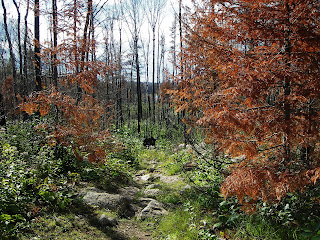 Once adorned with jack pine, black spruce, and pockets of paper birch, few trees survived the flames. Early Precambrian bedrock, once concealed by a thin layer of organic matter is exposed; its white surface a distinct contrast to the charcoal colored snags still standing on the hillside.
As we paddle northward across Gunflint Lake the wind howls in our faces. With Ken and the helm of our canoe, I steer us towards the channel to Magnetic Lake. We fight the wind across the lake and I try to keep the canoe perpendicular to the wind. This proves difficult and I exert a lot of energy keeping us on track towards Magnetic Lake. One gust catches Ken’s India Jones hat and it flies off his head, nearly hits me in the face, and lands in the choppy lake behind us. In a maneuver so stupid it’s impressive, I quickly turn the canoe broadside to the wind and let the force of the wind turn us 180 degrees. We paddle as hard as we can towards the hat as it begins to sink. We barely lose the hat and we fight to turn the canoe into the wind. We make it, but only nearly. The hat does not.
According to historians, the Granite-Pine River system was part of a heavily traveled route used by Indians and Voyageurs transporting their furs northward towards the Hudson Bay. The river follows the international border with Canada – a one-time imaginary line separating the two countries, now easily demarcated by small silver cairns. Now we paddle the scenic river system as part of an escape from the bustle of modern day life. We paddle out of the complex, into the simple – a realm where only survival and direct physical experience prevail. One thing to keep in mind though, ‘simple’ does not necessarily equate to ‘easy’.
After a few short portages we come to the first set of rapids, Little Rock Falls.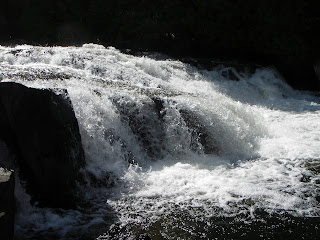 We stop to evaluate the fifteen foot drop. We decide not to run the rapids. As they say, “the wilderness is no place to take unnecessary chances”. To which I say, “You’re right, we’ve got a big enough challenge ahead of us anyways”.
A bit further north along the Granite River and we come to our first major portage. The Pine Portage, as it’s called, is a 110 rod carry along a trail that first climbs to the island’s high point and then descends down a long, steep drop to Clove Lake. Once on Clove Lake, we make our first night’s camp. We unload our gear, set up the tents, and prepare the bear hang (you gotta hang your food from a tree out here to make sure the bears don’t get at it). The sun goes down behind the thick cloud cover, giving us barely a glimpse of a sunset.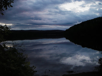 As darkness settles in, we sip Windsor and tell stories, laughing and drinking until the fatigue from the day’s paddling sets in and we drift off to sleep.
I awake refreshed – I always sleep well in the Boundary Waters. The fresh air and the physical exertion combine to make for a restful night of sleep. We take our time breaking down the camp, sipping hot coffee to get us prepped for the day’s adventure. In the late morning we set out.
Our first excitement is not long in coming as we run a few short rapids before portaging into Gneiss Lake. We round the Devil’s Elbow without incident and paddle our way to Marboeuf Lake. A little farther north and we come to Horsetail Rapids which the guidebooks indicate are not safe to run.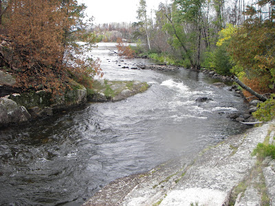 Regardless, I am anxious to try our luck and Jonah jumps into my canoe, which I’d been paddling solo, for the ride. Thing is, Jonah gets in with no paddle and convinces me that we don’t need a second paddle. Ok. I know what you’re thinking. You’re thinking “are you a complete idiot?” Well, my only answer is: yes, this was a bad choice. So, with one paddle, we start down the rapids and immediately encounter problems as the weight of Jonah in the front, with no leverage to provide, lead us straight towards a boulder I was intentionally trying to avoid. In seconds, our canoe is capsized and we are thrown into the river. We float the rest of the way down the rapids and are able to salvage ourselves and the canoe. No harm done, although we’re soaked. Oh, and so is the food basket. Opps.
The next two days are spent working our way north along the Pine River towards Saganaga Lake. The weather is mild – overcast and cool. We find amazing campsites embedded in little pockets of unburned pines and spend our evenings sipping Windsor and playing scrabble. We don’t build any fires due to the fire ban.

My perspective as we head north.

Paul - paddling solo.

Jonah - portage master.
On day four, we portage around Saganaga Falls, a picturesque 6 foot cascade that dumps into Saganaga Lake. The beast. We head north on Saganaga briefly before turning southwest on our route towards Seagull Lake and the end of our trip. The weather is pleasant along this stretch, sunny and cool with very little wind. We paddle leisurely along the lake’s eastern shore, headed south. In no great hurry to exit the Wilderness, we decide to spend our last night in James Bay, roughly four miles north of Trail’s End. We sneak in one last game of scrabble, drink some whiskey and spend our last afternoon in the wilderness relaxing.
Shortly before sunset, the wind begins to pick up and the clouds start to roll in. Soon afterwards, a steady drizzle begins to soak the earth. Sometime in the middle of the night the winds pick up and the drizzle becomes a downpour. Morning comes with little positive change in weather. Three foot rollers crash against the shoreline and whitecaps cover the lake. The rain lets up slightly as we finish our coffee and start to break camp. There is some lengthy discussion regarding who will be paddling the solo canoe. Paul ends up volunteering, more by the lack of interest by the rest of us that by his desire to brave the rollers on his own.
We set out from the shore, a sense of anxiety and foreboding dominate my psyche as we paddle into the wind and out of James Bay into the frothing, turbulent Saganaga. We try with all our might to paddle south but are forced to paddle into the gale force winds coming from the west – a side wind with lots of potential for dumping our canoes. We struggle for what seems like an hour to make it roughly a quarter-mile to a small refugia on the leeward side of a small island. We reach shore and decide to attempt to wait out the storming waters.

The winds continue to pummel us as we hold up on the island – discussing every possible plan we can muster for making it back safe. The wind does not subside and the waves only seem to worsen. Finally we decide to paddle to the shoreline a short distance east of the island. From there we decide that we can portage our gear all the way back to Trail’s End, or until the lake calms down. Unfortunately there are no trails for us to utilize and we end up having to bushwhack our way through forest, over ridge, across bogs, and with a few dicey paddles across open water we make it to the narrows leading to Seagull Lake.
At this point the steep ridge to the west protects the narrows from the winds and the whitecaps disappear. Exhausted from the four mile portage, we hop in our canoes and paddle the rest of the way to Trail’s End. An hour later we’re in Grand Marais drinking beer and eating burgers at the Gunflint Tavern. We’ve survived another adventure in the Boundary Waters…
A final stop to pick up Ken and we’re off. I look at the glowing clock on the dashboard. It reads: 9:30 PM. A late start. We head north, leaving the city lights of Duluth behind us. The rain pummels the earth.
We pull into Grand Marais around 12:30 AM – just in time to miss last call at the Howlin’ Wolf. The Gunflint Tavern is dark. Nick persuades us to get a room at a local hotel rather than try to make camp in the rain and pack up wet gear in the morning. Logical. We get a room and I fall asleep.
In the morning I rise early and grab some continental breakfast. I try to make small talk with the young Russian girls working at the hotel. Their English is good but they fail to catch my subtle innuendos. I’d like to take one of them with me – Katherina – she says she’s never been canoeing. I consider the opportunity and reconsider. The guys appear, I say my goodbyes to Katherina, and we make for the Gunflint Trail – gateway to the Wilderness.
The sky is dark, but dry. We pull up to the Gunflint Lake boat launch. Our entry into the Boundary Waters will be Magnetic Lake, just north of Gunflint.
 As its name suggests, Magnetic Lake exhibits an interesting geologic phenomenon which causes magnets, such as those in a compass, to deflect from the true magnetic north. Luckily the lake is relatively small and we know where we’re headed. My compass never leaves my pocket.
It’s readily apparent that the magnitude of the recent Ham Lake fire is enormous. The northern shore of Gunflint and Magnetic lakes are scarred by the blackened remains of a previously lush boreal forest.
 Once adorned with jack pine, black spruce, and pockets of paper birch, few trees survived the flames. Early Precambrian bedrock, once concealed by a thin layer of organic matter is exposed; its white surface a distinct contrast to the charcoal colored snags still standing on the hillside.
 As we paddle northward across Gunflint Lake the wind howls in our faces. With Ken and the helm of our canoe, I steer us towards the channel to Magnetic Lake. We fight the wind across the lake and I try to keep the canoe perpendicular to the wind. This proves difficult and I exert a lot of energy keeping us on track towards Magnetic Lake. One gust catches Ken’s India Jones hat and it flies off his head, nearly hits me in the face, and lands in the choppy lake behind us. In a maneuver so stupid it’s impressive, I quickly turn the canoe broadside to the wind and let the force of the wind turn us 180 degrees. We paddle as hard as we can towards the hat as it begins to sink. We barely lose the hat and we fight to turn the canoe into the wind. We make it, but only nearly. The hat does not.
According to historians, the Granite-Pine River system was part of a heavily traveled route used by Indians and Voyageurs transporting their furs northward towards the Hudson Bay. The river follows the international border with Canada – a one-time imaginary line separating the two countries, now easily demarcated by small silver cairns. Now we paddle the scenic river system as part of an escape from the bustle of modern day life. We paddle out of the complex, into the simple – a realm where only survival and direct physical experience prevail. One thing to keep in mind though, ‘simple’ does not necessarily equate to ‘easy’.
After a few short portages we come to the first set of rapids, Little Rock Falls.
 We stop to evaluate the fifteen foot drop. We decide not to run the rapids. As they say, “the wilderness is no place to take unnecessary chances”. To which I say, “You’re right, we’ve got a big enough challenge ahead of us anyways”.
 A bit further north along the Granite River and we come to our first major portage. The Pine Portage, as it’s called, is a 110 rod carry along a trail that first climbs to the island’s high point and then descends down a long, steep drop to Clove Lake. Once on Clove Lake, we make our first night’s camp. We unload our gear, set up the tents, and prepare the bear hang (you gotta hang your food from a tree out here to make sure the bears don’t get at it). The sun goes down behind the thick cloud cover, giving us barely a glimpse of a sunset.
 As darkness settles in, we sip Windsor and tell stories, laughing and drinking until the fatigue from the day’s paddling sets in and we drift off to sleep.
I awake refreshed – I always sleep well in the Boundary Waters. The fresh air and the physical exertion combine to make for a restful night of sleep. We take our time breaking down the camp, sipping hot coffee to get us prepped for the day’s adventure. In the late morning we set out.
Our first excitement is not long in coming as we run a few short rapids before portaging into Gneiss Lake. We round the Devil’s Elbow without incident and paddle our way to Marboeuf Lake. A little farther north and we come to Horsetail Rapids which the guidebooks indicate are not safe to run.
 Regardless, I am anxious to try our luck and Jonah jumps into my canoe, which I’d been paddling solo, for the ride. Thing is, Jonah gets in with no paddle and convinces me that we don’t need a second paddle. Ok. I know what you’re thinking. You’re thinking “are you a complete idiot?” Well, my only answer is: yes, this was a bad choice. So, with one paddle, we start down the rapids and immediately encounter problems as the weight of Jonah in the front, with no leverage to provide, lead us straight towards a boulder I was intentionally trying to avoid. In seconds, our canoe is capsized and we are thrown into the river. We float the rest of the way down the rapids and are able to salvage ourselves and the canoe. No harm done, although we’re soaked. Oh, and so is the food basket. Opps.
The next two days are spent working our way north along the Pine River towards Saganaga Lake. The weather is mild – overcast and cool. We find amazing campsites embedded in little pockets of unburned pines and spend our evenings sipping Windsor and playing scrabble. We don’t build any fires due to the fire ban.

My perspective as we head north.

Paul - paddling solo.

Jonah - portage master.
On day four, we portage around Saganaga Falls, a picturesque 6 foot cascade that dumps into Saganaga Lake. The beast. We head north on Saganaga briefly before turning southwest on our route towards Seagull Lake and the end of our trip. The weather is pleasant along this stretch, sunny and cool with very little wind. We paddle leisurely along the lake’s eastern shore, headed south. In no great hurry to exit the Wilderness, we decide to spend our last night in James Bay, roughly four miles north of Trail’s End. We sneak in one last game of scrabble, drink some whiskey and spend our last afternoon in the wilderness relaxing.
Shortly before sunset, the wind begins to pick up and the clouds start to roll in. Soon afterwards, a steady drizzle begins to soak the earth. Sometime in the middle of the night the winds pick up and the drizzle becomes a downpour. Morning comes with little positive change in weather. Three foot rollers crash against the shoreline and whitecaps cover the lake. The rain lets up slightly as we finish our coffee and start to break camp. There is some lengthy discussion regarding who will be paddling the solo canoe. Paul ends up volunteering, more by the lack of interest by the rest of us that by his desire to brave the rollers on his own.
We set out from the shore, a sense of anxiety and foreboding dominate my psyche as we paddle into the wind and out of James Bay into the frothing, turbulent Saganaga. We try with all our might to paddle south but are forced to paddle into the gale force winds coming from the west – a side wind with lots of potential for dumping our canoes. We struggle for what seems like an hour to make it roughly a quarter-mile to a small refugia on the leeward side of a small island. We reach shore and decide to attempt to wait out the storming waters.

The winds continue to pummel us as we hold up on the island – discussing every possible plan we can muster for making it back safe. The wind does not subside and the waves only seem to worsen. Finally we decide to paddle to the shoreline a short distance east of the island. From there we decide that we can portage our gear all the way back to Trail’s End, or until the lake calms down. Unfortunately there are no trails for us to utilize and we end up having to bushwhack our way through forest, over ridge, across bogs, and with a few dicey paddles across open water we make it to the narrows leading to Seagull Lake.
At this point the steep ridge to the west protects the narrows from the winds and the whitecaps disappear. Exhausted from the four mile portage, we hop in our canoes and paddle the rest of the way to Trail’s End. An hour later we’re in Grand Marais drinking beer and eating burgers at the Gunflint Tavern. We’ve survived another adventure in the Boundary Waters…
Wednesday, May 30, 2007
Redfield Canyon Wilderness
Whiskey. I stop at the Wilcox IGA and pace the aisles looking for the spirits. Last time I passed through town I found my favorite demon – Canadian Windsor – which reminds me of the North Country and the many nights huddled around the campfire with my compañeros, sipping whiskey after a long day paddling The Boundary Waters Wilderness. So I make one last reluctant stop in Wilcox to grab a fifth before embarking on the last leg of my journey into the Galiuro Mountains northwest of town. While I was absolutely amazed to find Windsor here last time, I'm equally suprised that they don't seem to have it in stock. I could easily replace it with Wild Turkey or the lesser of two evils, Jack Daniels, but I'm a particular kind of whiskey drinker and I hold out. I make a second stop at the only other grocery in town. I ask the clerk for assistance to save time but end up listening to a long winded story about why they don't carry Windsor and why they don't stock fifths of anything. He directs me to Milo's – the only true liquor store in town. Against my better judgment, I make one last ditch effort for the sweet, caramel libation. All Milo has to say is "Canadian whiskey, boy we're less than sixty miles from Mexico. How about a cheap tequila?" I decline and hop back into my truck, saddened that my tastes are too particular for compromise. I tell myself that it's about the experience, not the intoxication. That sentiment assuages my thirst for less than a minute. Reluctantly, I decide that this is going to be a dry trip. I pull out of the gravel parking lot, kicking up dust in protest.
I cross the interstate and find Airport Road, but no airport in sight. The road leads west towards the Winchester Mountains and beyond, the Galiuros, and somewhere in that remote mountain range my destination – Redfield Canyon Wilderness. The road winds around the southern extent of the Winchesters, past a number of old ranches, War Bonnet Ranch, the Winchester Ranch, and finally to the Muleshoe Ranch – now owned by The Nature Conservancy and managed as a wildlife preserve. The Muleshoe Preserve is a lush oasis in the otherwise barren rangelands surrounding the mountains. I stop in at the ranch house and have a chat with one of the preserve managers, Wes. We cover the conversational formalities so very common in the region – the drought, the heat, the population explosion, the "old days", and the like. I get the distinct feeling that Wes and I share some common values – a love for wild places, a desire to escape the inconsequential ruckus of city life – although Wes seems to be doing a better job at actualizing these ideals. When I ask him if he enjoys working for The Nature Conservancy, he tells me that he's been there for ten years. I take the hint. Like any conscientious visitor, I thank him for the job he's doing, the nice conversation, and (especially) the access – the preserve straddles the only direct trail to Redfield Canyon and closure of the road could make accessing the canyon a hell of a lot more difficult. We agree that human population lies at the crux of all the world's problems and I press on, anxious to forget that very thing. I pass across the last cattle guard and begin the slow drive on a single lane two-track into the heart of the Galiuro Mountains at a snail's pace – four wheel drive and first gear the whole way. The irony does not escape me – driving into the wilderness, decadent and convenient.
The confluence of Bass Canyon, Hot Springs Canyon, and Sierra Blanca Canyon, all perennial streams, creates a luxuriant riparian area rich and diverse in plant life – cottonwoods and willows side-by-side with oak and juniper. All kinds of unnamable herbaceous life thrive beneath their shade (unnamable due only to my inability to name them). The trail snakes its way northward, up and down rocky canyon slopes, traversing the western edge of the Galiuro Moutnains fourteen and some odd tenths of a mile to Jackson Cabin – the heart of the Redfield Canyon Wilderness. Jackson Cabin will be my base camp for the next few days.
I see absolutely no human along those sinuous fourteen miles, only a roadrunner – running down the road, turkey vultures circling overhead (why are they always following me), and the occasional flash of some dickey bird too fast for me to get my field glasses to my face before disappearing.

Wilderness Boundary
Late in the afternoon I arrive at Jackson Cabin, deep in the heart of the Redfield Canyon Wilderness. The canyon itself is a narrow red-walled chasm lined by tall cliffs interrupted by shallow caves created over centuries of scouring by the rise and fall of the river. There are no established trails and the multitude of small adjoining canyons creates a veritable labyrinth for careful exploration.

Jackson Cabin
I packed my essentials and start out from Jackson Cabin, headed south along a faint game trail south along Jackson Canyon to its confluence with Redfield Canyon. There's ample water in the river and lush vegetation – young willows and tall, majestic cottonwoods. I hike south for a couple of hours, stopping occasionally to breathe in the solitude, exhaling the tension carried with me from "the world". Later, farther south, I locate a small shelf in the canyon wall that's flat and wide enough to allow me to lay out my bedroll. As darkness descends into the deep canyon, I snack on dried fruit and sip the refreshing water provided by the wilderness. Tired from my hike, I drift off to sleep as screech owls call out in the distance.

Redfield Canyon
The next day, I head back north and in the late morning I pass by Jackson Canyon. I'm not ready to return to Jackson Cabin quite yet, so I continue up Redfield Canyon. Soon the canyon floor becomes steep and choked with gigantic boulders that fell from the canyon walls long before I breathed this Earth's air. I scrambled up the canyon, picking my way among the boulders. After a mid-day snack, I continue north – climbing ever upwards in a portion of the canyon that will be impassable during the monsoons when my boulder strewn path gives way to flowing waterfalls and deep pools. In some places, shallow pools remain from the previous season's rains, and the distinct sign of the canyons inhabitants – the mule deer, the javelina, and the cougar are obvious in the drying mud along the edges of the pools.
Mid-day gives way to afternoon, and the early nightfall quickly approaches and the sun dips below the steep canyon walls to the west. At this point, I realize that I had better find a good spot to camp, or b-line it for the cabin. Of course, there's no such thing as a b-line in this terrain. Somewhere south of Mitchell Canyon, I turn south and begin to climb out of Redfield Canyon towards what I think (hope) is an unnamed drainage from Walnut Spring.

Walnut Spring
I flush up two mule deer does along my way and stop for a look at the spring before descending back to Jackson Cabin. As the moon rises, I arrive at the cabin and build a fire. I light a cheap cigar and appreciate my opportunity to have this intimate encounter with the Wild.

Female Mule Deer

I cross the interstate and find Airport Road, but no airport in sight. The road leads west towards the Winchester Mountains and beyond, the Galiuros, and somewhere in that remote mountain range my destination – Redfield Canyon Wilderness. The road winds around the southern extent of the Winchesters, past a number of old ranches, War Bonnet Ranch, the Winchester Ranch, and finally to the Muleshoe Ranch – now owned by The Nature Conservancy and managed as a wildlife preserve. The Muleshoe Preserve is a lush oasis in the otherwise barren rangelands surrounding the mountains. I stop in at the ranch house and have a chat with one of the preserve managers, Wes. We cover the conversational formalities so very common in the region – the drought, the heat, the population explosion, the "old days", and the like. I get the distinct feeling that Wes and I share some common values – a love for wild places, a desire to escape the inconsequential ruckus of city life – although Wes seems to be doing a better job at actualizing these ideals. When I ask him if he enjoys working for The Nature Conservancy, he tells me that he's been there for ten years. I take the hint. Like any conscientious visitor, I thank him for the job he's doing, the nice conversation, and (especially) the access – the preserve straddles the only direct trail to Redfield Canyon and closure of the road could make accessing the canyon a hell of a lot more difficult. We agree that human population lies at the crux of all the world's problems and I press on, anxious to forget that very thing. I pass across the last cattle guard and begin the slow drive on a single lane two-track into the heart of the Galiuro Mountains at a snail's pace – four wheel drive and first gear the whole way. The irony does not escape me – driving into the wilderness, decadent and convenient.
The confluence of Bass Canyon, Hot Springs Canyon, and Sierra Blanca Canyon, all perennial streams, creates a luxuriant riparian area rich and diverse in plant life – cottonwoods and willows side-by-side with oak and juniper. All kinds of unnamable herbaceous life thrive beneath their shade (unnamable due only to my inability to name them). The trail snakes its way northward, up and down rocky canyon slopes, traversing the western edge of the Galiuro Moutnains fourteen and some odd tenths of a mile to Jackson Cabin – the heart of the Redfield Canyon Wilderness. Jackson Cabin will be my base camp for the next few days.
I see absolutely no human along those sinuous fourteen miles, only a roadrunner – running down the road, turkey vultures circling overhead (why are they always following me), and the occasional flash of some dickey bird too fast for me to get my field glasses to my face before disappearing.
Wilderness Boundary
Late in the afternoon I arrive at Jackson Cabin, deep in the heart of the Redfield Canyon Wilderness. The canyon itself is a narrow red-walled chasm lined by tall cliffs interrupted by shallow caves created over centuries of scouring by the rise and fall of the river. There are no established trails and the multitude of small adjoining canyons creates a veritable labyrinth for careful exploration.
Jackson Cabin
I packed my essentials and start out from Jackson Cabin, headed south along a faint game trail south along Jackson Canyon to its confluence with Redfield Canyon. There's ample water in the river and lush vegetation – young willows and tall, majestic cottonwoods. I hike south for a couple of hours, stopping occasionally to breathe in the solitude, exhaling the tension carried with me from "the world". Later, farther south, I locate a small shelf in the canyon wall that's flat and wide enough to allow me to lay out my bedroll. As darkness descends into the deep canyon, I snack on dried fruit and sip the refreshing water provided by the wilderness. Tired from my hike, I drift off to sleep as screech owls call out in the distance.
Redfield Canyon
The next day, I head back north and in the late morning I pass by Jackson Canyon. I'm not ready to return to Jackson Cabin quite yet, so I continue up Redfield Canyon. Soon the canyon floor becomes steep and choked with gigantic boulders that fell from the canyon walls long before I breathed this Earth's air. I scrambled up the canyon, picking my way among the boulders. After a mid-day snack, I continue north – climbing ever upwards in a portion of the canyon that will be impassable during the monsoons when my boulder strewn path gives way to flowing waterfalls and deep pools. In some places, shallow pools remain from the previous season's rains, and the distinct sign of the canyons inhabitants – the mule deer, the javelina, and the cougar are obvious in the drying mud along the edges of the pools.
Mid-day gives way to afternoon, and the early nightfall quickly approaches and the sun dips below the steep canyon walls to the west. At this point, I realize that I had better find a good spot to camp, or b-line it for the cabin. Of course, there's no such thing as a b-line in this terrain. Somewhere south of Mitchell Canyon, I turn south and begin to climb out of Redfield Canyon towards what I think (hope) is an unnamed drainage from Walnut Spring.
Walnut Spring
I flush up two mule deer does along my way and stop for a look at the spring before descending back to Jackson Cabin. As the moon rises, I arrive at the cabin and build a fire. I light a cheap cigar and appreciate my opportunity to have this intimate encounter with the Wild.
Female Mule Deer
Monday, March 5, 2007
Squeezing Another Lemon Weekend
We got another 8 inches of snow over the week - which meant a second visit to our very own Mount Lemon. Steve joined Scott and I for some serious shreddin'. I recommend that everyone in Tucson take the next opportunity to get up there and ride!
A side note: NPR played a bit this morning on using reclaimed water for making snow on the slopes. No doubt this would extend the number of days that the resort is open each year - it also gives real credence to the phrase "yellow snow". No snow cones for me please.
Scotty hangin' at the chalet:

Steve and I on the chairlift:

View from the one (and only) chairlift:


Sluggin' beers post ride:

A side note: NPR played a bit this morning on using reclaimed water for making snow on the slopes. No doubt this would extend the number of days that the resort is open each year - it also gives real credence to the phrase "yellow snow". No snow cones for me please.
Scotty hangin' at the chalet:

Steve and I on the chairlift:

View from the one (and only) chairlift:


Sluggin' beers post ride:

Wednesday, January 31, 2007
Galiuro Wilderness - Deer Creek Trail
I don't consider myself much of a 'blogger'. So - long story short - I took a hike to where I thought I was, but wasn't. Made for an interesting weekend journey into the Galiuro Wilderness in southeast Arizona.

Ron says that he 'glanced' at the map, but neither of us paid it much attention. I guess we just figured we figure it out.
Didn't matter much anyhow. The scenery was amazing...


We definately could've used a few more of these!

Saturday, January 27, 2007
Southern-Most Ski Resort in the Nation...
...And the winner is... Mt. Lemon's Ski Valley!

I'm not even kidding. We've got our very own ski resort right here in Tucson! One double chair, 13 runs, and this winter we even have snow. Last weekend's storms dumped roughly 14 inches of fresh snow on the peaks and with the reasonably cold weather we had this week, north facing slopes kept their accumulation. Add in the dusting of almost 2 inches Thursday, and you've got snowboarding at the southernmost ski resort in the Nation.


Sure there were some exposed boulders here an there. Sure there were a bunch of drunk desert rats doing thier best to get in my way. Sure Kenny G made a guest appearance. But nothing was stopping me from enjoying my second weekend of riding in Arizona (see my previous blog entry for details on the Sunrise trip).
It was frickin' fabulous. I wish you all were there. Maybe you were...


I'm not even kidding. We've got our very own ski resort right here in Tucson! One double chair, 13 runs, and this winter we even have snow. Last weekend's storms dumped roughly 14 inches of fresh snow on the peaks and with the reasonably cold weather we had this week, north facing slopes kept their accumulation. Add in the dusting of almost 2 inches Thursday, and you've got snowboarding at the southernmost ski resort in the Nation.


Sure there were some exposed boulders here an there. Sure there were a bunch of drunk desert rats doing thier best to get in my way. Sure Kenny G made a guest appearance. But nothing was stopping me from enjoying my second weekend of riding in Arizona (see my previous blog entry for details on the Sunrise trip).
It was frickin' fabulous. I wish you all were there. Maybe you were...

Monday, January 22, 2007
An Accidental 3-Day Weekend!
What an epic weekend. Scott and I ducked out a bit early Friday and headed north - bound for the Sunrise. Tucson was wet, clouds shrouded the Catalinas, and we craved the fresh powder that we new would be blanketing the White Mountains. We took the scenic route out of Tucson, past Globe and onward into the Salt River Canyon. The canyon itself was sacked in with fog, making the sinuous highway a bit trecherous as we descended to the Salt River and then crawled northward up numerous hairpin turns through the pinion-juniper and up into the pine forests on the Mogollon Rim.
The weather gradually changed from rain to sleet and finally snow as we neared Show Low. We stayed at our pal Mike's place, crashing almost immediately upon arriving at his place in Concho.
We spent the next two days riding some of the best powder I've seen in a long, long time. It snowed both days - creating a never ending sea of fresh turns on Sunrise and Apache peaks. Pure heaven. Unless you've experienced it, there is really no way to describe the feeling of making turns in 3+ feet of fresh powder.


Somewhere along the way, we lost any sense of heading home, and by the time we decided to head out on Sunday, the storm of the year pummeled the Whites - leaving around 8 inches of fresh snow over the ice-glazed highway. We crept along, passing through Show Low and heading south towards the Salt River Canyon once again. The wind howled, the snow drifted, and we inched closer and closer to the edge of the Mogollon Rim and the steep abyss that lay ahead. As we neared the drop, we noticed an unusually heavy amount of traffic headed northward back towards Show Low. A short time later, we found ourselves headed back the way we'd come, turned back from the Salt River Canyon with a road closure due to "Extreme Winter Driving Conditions".
Luckily, we made it safely back to Mike's. We crashed and finally got a clear shot at the canyon this morning. Along the way, we saw 4 cars being towed from the ditches along the highway.
There's something to be said for the accidental three-day weekend!

The weather gradually changed from rain to sleet and finally snow as we neared Show Low. We stayed at our pal Mike's place, crashing almost immediately upon arriving at his place in Concho.
We spent the next two days riding some of the best powder I've seen in a long, long time. It snowed both days - creating a never ending sea of fresh turns on Sunrise and Apache peaks. Pure heaven. Unless you've experienced it, there is really no way to describe the feeling of making turns in 3+ feet of fresh powder.


Somewhere along the way, we lost any sense of heading home, and by the time we decided to head out on Sunday, the storm of the year pummeled the Whites - leaving around 8 inches of fresh snow over the ice-glazed highway. We crept along, passing through Show Low and heading south towards the Salt River Canyon once again. The wind howled, the snow drifted, and we inched closer and closer to the edge of the Mogollon Rim and the steep abyss that lay ahead. As we neared the drop, we noticed an unusually heavy amount of traffic headed northward back towards Show Low. A short time later, we found ourselves headed back the way we'd come, turned back from the Salt River Canyon with a road closure due to "Extreme Winter Driving Conditions".
Luckily, we made it safely back to Mike's. We crashed and finally got a clear shot at the canyon this morning. Along the way, we saw 4 cars being towed from the ditches along the highway.
There's something to be said for the accidental three-day weekend!

Sunday, January 7, 2007
Aggressive Negotiations
On Saturday I met up with my realtor and looked at a few places in Catalina. The first was a nice little house on 0.5 acres. It wasn't anything special, but it was well maintained and had a great view of the Catalina Mountains from the backyard. We looked at a few loser mobiles (puke), and finally a small house on 1 acre. It had tremendous views. Four ranges could be seen from the deck - the Catalina, Tortolita, Tucson, and Sierrita Mountains. You could literally sit on that deck all day and watch the sun rise and then set. The view caught my interest right away. The house itself was nice – open floor plan, sky-lights in the kitchen, two bedrooms and two bathrooms, etc. It was a bit bigger than the first house and the property was lush with native vegetation and avifauna - quail running through the yard and thrashers and wrens calling from their cholla and palo verde perches.
I pondered a potential offer Saturday night and today, I met with my realtor to write up an offer. Let me set this up for you a bit. A series of important details indicated to me that I could go in with a very aggressive offer. First of all, the house has been on the market for almost 4 months. Secondly, the listing stated that the owner was very motivated and that all offers were welcome. And then there was the little slip their realtor made in mentioning that they'd had very few showings.
So much to the chagrin of my realtor (I could actually hear him sigh over the phone), I decided to offer $40k below the asking price. Gutsy eh? Well, you have to realize that I am in absolutely no hurry to get myself into a mortgage on an overvalued piece of property - especially in this market. Yeah, the view was spectacular, but there are other properties in the same area that would suit me just as well. So no, I didn't have-to-have this particular house. Also, I have a very ideal living situation right now that does not force me to make a hasty decision. I feel that I have the upper hand in this one. I don't expect them to take my offer outright, but I do expect them to come down a bit. I have no idea what type of response I'll get, but I feel like I really have nothing to lose. We'll see what happens…
Looking east towards the Catalina Moutnains:

I pondered a potential offer Saturday night and today, I met with my realtor to write up an offer. Let me set this up for you a bit. A series of important details indicated to me that I could go in with a very aggressive offer. First of all, the house has been on the market for almost 4 months. Secondly, the listing stated that the owner was very motivated and that all offers were welcome. And then there was the little slip their realtor made in mentioning that they'd had very few showings.
So much to the chagrin of my realtor (I could actually hear him sigh over the phone), I decided to offer $40k below the asking price. Gutsy eh? Well, you have to realize that I am in absolutely no hurry to get myself into a mortgage on an overvalued piece of property - especially in this market. Yeah, the view was spectacular, but there are other properties in the same area that would suit me just as well. So no, I didn't have-to-have this particular house. Also, I have a very ideal living situation right now that does not force me to make a hasty decision. I feel that I have the upper hand in this one. I don't expect them to take my offer outright, but I do expect them to come down a bit. I have no idea what type of response I'll get, but I feel like I really have nothing to lose. We'll see what happens…
Looking east towards the Catalina Moutnains:

Subscribe to:
Posts (Atom)